Friday, July 15, 2016

Monte Elmo Ridge Walk


Crazy crenelations across the valley
On the north-eastern fringes of the range, on just the European side of the Peri-Adriatic Fault, which divides the European Plate from the African Plate, the geology determines a different kind of mountain from the crazy, crenelated pinnacles of Dolomitic Limestone on the other side of the valley.

Here grassy slopes, broken with outcroppings of schist, rise smoothly to an undulating grassy/rocky crest running NW to SE, and marking the border between Austria and Italy. This is skiing country, above Sexten, and the gondola at Vierschach takes you effortlessly up to 2000m asl (above sea level). From the gondola station you can walk the ridge over Monte Elmo, past the Sillianer Hutte and continue to the Rotecksattel.

You begin with a climb and if you've been at sea level the shortness of oxygen makes you gasp a bit – the summit of Monte Elmo, with its disused hut is at 2434m. I suggest avoiding its steep and eroded SW ridge. I much prefer the NW ridge which is less used and breaks through some exposed and interesting rock bands around 2300m.

Up through the bands of schist - it looks a bit Scottish!
The ridge continues, an airy walk and on a clear day gives a succession of 360° views over grassy meadows full of alpine flowers to distant mountains; leftwards to the Austrian Tyrol and rightwards to the majestic Dolomites.
Along the ridge
Descending from the ridge through Alpenrose

Who's looking at whom?
The Sillianer Hutte is best avoided on busy days – earlier this year my group gave up waiting for their order after 45 minutes. Better to picnic amongst the marmots which swarm the slopes, their warning whistles heard long before they can easily be seen.


From the Rotecksattel we left the ridge and dropped into the valley to about the 2000m contour line before turning back towards the north-west and the Klammbachalm hutte, after which a short but leg burning burst takes you up to the Tre Cime Gondola. We were late after our failed hut stop and rushed, headlong - a bit like the previous sentence.
A pause between mountains

If you’ve had the foresight to buy a return ticket from Vierschach this gets you swiftly down to the roadside and a bus ride back to San Candido.

July in the Dolomites


I love the Dolomites.
Lago di Braies
 This region of the Alps lies mostly within Italy since the end of WW1 though it’s culturally got more in common with Austria. The reason I love it is mostly down to its geology. The mountains are made of Dolomitic Limestone. This rock is prone to erode into fantastic pinnacles and razor ridges at the mountain heights. It produces large pinkish off-white scree fans and chutes which cut through dark green coniferous trees as they tumble to the valley bottoms.
Croda Fiscaline and Cima Una
The mountains are not as high as some other areas of the alps with the higher massifs topping out just above 300m asl but this enhances their scenic qualities – the mountains are near, not impossibly distant as sometimes mountains appear above Chamonix or Zermatt.
Croda Rossa from Prato Piazza

And then there’s the flowers. The soil is full of nutrients. It appears sometimes to be alkaline and sometimes acid and supports a fantastic variety of wildflowers and insects.

Martagon Lily
Fire Lily
In June/July, when I was leading some hiking tours these flowers are at their magnificent best.


Tuesday, July 12, 2016

Catch-up from Como

I'm back in the UK after a month away in Italy; it's all work, work, work for me. There's lots to report but as usual I haven't found time to write to my blog whilst away. Here are some catch-up entries, beginning with Lake Como.
My friends in early morning sunshine at Rezzonico on the western shore of Lake Como
 I spent a couple of weeks alongside Lake Como, the first with Jude doing the last preparation for the second week, with my lovely "Pacemakers" walking group. This was the tenth annual walking trip we've done and it's definitely become a habit. Although I've been leading trips for Explore by Lake Como for a couple of years I wanted something different so I spent the first week exploring some new walks. The first of my two favourites was a section of the Sentiero delle Viandante on the eastern shore of the lake.
From Gravedona Jude and I took a lake ferry across to Piona and disembarked alone. We found our path nestling uncomfortably alongside a fence at first but it soon improved, taking some zig-zags as it climbed up the the whaleback crest of the peninsula on our way to Olgiasca.
On the whaleback ridge before Olgiasca
 This was a lovely section of path through natural woodland above cliffs where we found climbers. It seems little walked.
From Olgiasca we had a few hundred metres along the road to Dorio. There's a path I found later in my visit that goes directly up from Dorio to the chapel of San Giorgio in Mandonico where we joined the Sentiero delle Viandante.
Jude re-lacing near Madonico
This path winds delightfully through the old hamlet of Mandonico and then climbs relentlessly up to a second chapel; Chiesetta di San Rocco. As it goes this path allows some terrific views southwards along the lake from above rocky bluffs.
Relentlessly up, but what a view above Dorio
Up again from San Rocco to round the ridge, traversing now all around the 500 - 600m contour, views north over Colico and into Val Chiavenna.
Northwards from the walk's highpoint towards the high mountains above Val Chiavenna
Shady walking towards Sparesee with beautiful views
Eventually, after the village of Sparesee the path starts to descend eastwards and onto a tarmac lane which zig-zags down to Posallo. A track now heads north from here before rejoining the tarmac on the outskirts of Colico. If you make it to the jetty in time the ferry will return you to Gravedona, otherwise it's a bus around the north of the lake.

Friday, June 3, 2016

Climbing on Grit

A joy of living where I do is Gritstone, or simply Grit. Grit is fantastic rock for us climbers. Its coarse surface gives wonderful friction and its lack of handholds and footholds demands imagination and good technique to envisage a way up, balance and momentum are key.
And the quintessential gritstone crag is Stanage Edge, close to Sheffield on the eastern border of the Peak District. For those lucky enough to live close by, climbing on summer evenings facing the setting sun is one of life's greatest pleasures.
Stanage Edge is home to more than 1500 different climbs along it's 4 miles length. None of them are high as the crag rarely gets above 20 metres. They're packed in a few metres apart wherever a visionary climber has spotted an unclimbed line. These days there are few lines left unclimbed with the potential for new routes and most those are at the hardest end of the range of climbing difficulty.
I've always wanted to put my name to a new climbing route, to be the first to spot and climb a line and to name it. A few weeks ago I noticed a few metres of what looked like lovely climbing up the top few metres of of a buttress next to where I was belaying for Jill. The rock below this was 'occupied' by another harder route but it looked possible to reach the nice finish via a traversing line below an overhang. Like the finish this traverse wasn't mentioned in the climbing guidebook. So that was around 10 metres of potential unclimbed route. I could reach the start of this climbing using the start of an existing route.
This all looked worthwhile. Instead of climbing existing guidebook routes next time we went out it was pioneering. My friends all stood back to leave me the opportunity to be the first. I took a while over the existing start and then spent a while longer fixing protection for myself in case of a fall. Stepping out onto the unclimbed line felt exciting and steepish; my weight was on my arms and again I took too long fixing more protection. I got into a steep groove where a high step took me up below the finishing section but my arm muscles had turned to jelly and I fell off, caught by my rope and belayer.
A week later I was back and this time, with foreknowledge, the route felt like a breeze. In a short 15 minutes I was at the top. My first ascent was followed by my friends. It's difficult to be objective but it feels as though it's a good addition to Stanage's climbs. It only remains for me to get it added to the next published guidebook.
And I get to name it. It was climbed on an evening when we were socialising in the name of Fidel Sciamanna. It's called "Fidel's Curry Night".

Blackden Brook

One of the consequences of working away from the UK for weeks at a time is that I end up appreciating home so much more. If I ever took it for granted I don't any more. After getting back from Italy I was determined to get out onto the Dark Peak moors to walk and climb.
One of the first opportunities came with the visit to Derbyshire of my friends Simon and Jan - we always try to get out for a day when they're up from Ipswich. This time I was going to take them to the Upper Derwent moors, using the weekend bus service that shuttles up alongside the Derwent and Howden Reservoirs on summer weekends. However, it turns out there's an interval of a few weeks in May during which the roa is closed to private cars but there's not yet a bus provided. So we thought again.
It was many years since I'd walked up onto the north side of Kinder taking Blackden Brook from the Snake Road. That's decided then.

Simon at the start
Blackden Brook is a deep V that heads up south away from the road. It's quite a long valley curving gently away until it rises steeply from under the rim of Kinder's northern rim. The small path seems to have little footfall and is hardly eroded. Once alongside the brook itself the path is narrow, sometimes jumping the brook, sometimes on flat sediments and often on the steep valley sides a few metres above the stream.
The valley narrows
It's not a path to fall off and there are places where the walking involves the use of the hands. We wandered along in the May sunshine and saw no-one, just a succession of pretty pools and tumbling waterfalls, hemmed in by the valley.
The climb up to the Plateau
Towards the end you start to climb and the valley floor steepens and becomes bouldery. The path hardly matters here as you scramble over and between lumps of brown gritstone gaining height rapidly now to reach the Kinder Rim path.
Looking north from the Rim
Immediately on gaining this point we saw other groups of walkers for the first time. The rest of the walk was on more familiar ground for me; along the rim westwards to Fairbrook then north to Fairbrook Naze, the steep ridge running down towards the Snake Inn on the A57. The plateau has changed over the last few years as the project to reduce the erosion starts to change the environment. Largely gone are the plain chocolate peat banks flanking the streams which created tufted islands of heather and bilberry hags. Onto the peat now grows grass, turning the landscape green and pale Naples yellow, a prairie landscape that seems to shimmer in the breeze.
A grassy landscape on the plateau
And so down the naze and back to the road in an hour. I love this landscape of moor and rock. It feels like home.
At the top of Fairbrook Naze


Saturday, April 16, 2016

Convento di Cospiti

The Convento di Cospiti, a medieval monastery sits on a cusp of rock ('Cospiti' comes from the Italian for cusp) 600m above sea level and the town of Vettica, near Amalfi. A steep footpath winds up by massive limestone cliffs from there, but a less exhausting way first climbs, then traverses in from San Lazzaro, finally dropping steeply to the ruins.
It's a remarkable place for a monastery, perched between bands of vertical and overhanging cliffs, above and below. The monks seem to have sought maximum solitude.


The shortest path from San Lazzaro is also the most exciting way in. From the top of the cliff, at an electricity pylon (I swear someone must be offering the utility companies a bonus for spoiling the most photogenic tourist viewpoints) the path turns steeply leftwards, down a ramp splitting the cliff diagonally.

The path turns downwards. The monastery is out of sight below, on the steep slopes on the right of the picture.
Our path winds between a looming cliff and a vertiginous drop into a gully, below a pinnacle poised above the path. Once in the gully the path turns down it. Cables fastened to the rock provide a handrail as you creep downwards with a mere suggestion of steps, concreted or carved into the rock.

The exciting bit of the path with its shiny, new chain
Lastly, a more recent, shiny chain protects the final turn out of the gully onto the slightly less vertigo inducing slopes below which sit the monastery ruins.

The ruins with Amalfi and the Capo d'Orsa below
First mention of a religious building on this site comes from the 11th century and it was used continuously until it's gradual decline towards the end of the 18th century. In the 14th century it was a pilgrimage destination and from then until 17th century was it's heyday. early in the 17th century. Terracing indicates the growing of food and these precipitous gardens are also to be found in the large cliff encircled bay to the south west where a further ruined chapel sits on a bluff of rock. I guess that this must have been associated with the monastery.

There's a barrel-vaulted building under a ledge on which a wooden cross has been mounted and above that an old wall built at the edge of a cave which was a hermitage. A story mentions this as a retreat for the prospective Pope Sixtus IV for a couple of years in the fifteenth century.
Cliffs with the wooden cross and the Sixtus hermitage

Today it's a quiet spot. Last week I visited for the first time amidst spring flowers including an early blooming Italian orchid. It's also known as the Naked Man orchid called because each of it's petals is shaped like a human figure with arms and legs, joined to the central stem at the head. Between it's 'legs' is the telltale spike which gives away the gender.
Naked Man Orchid (the man's in the lowest petals)
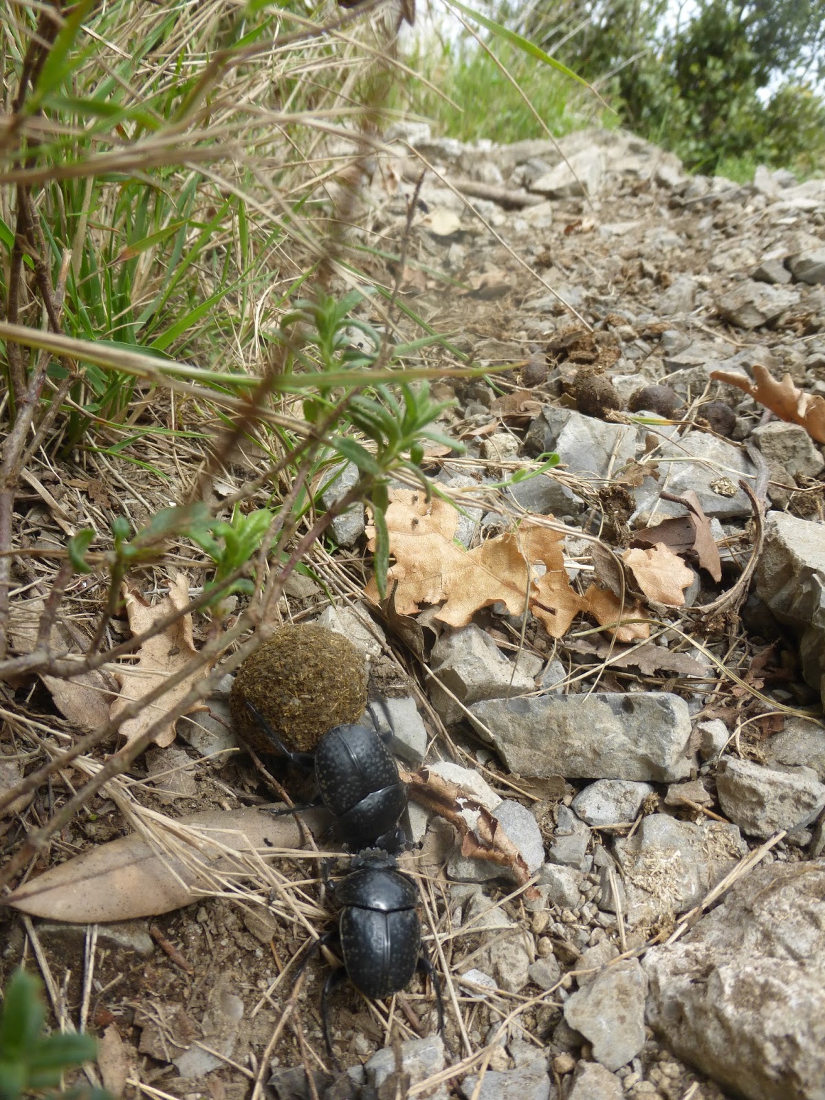
Dung beetles in their labour of Sysiphus


The place is alive with lizards and above soared a Kestrel and then a Peregrine Falcon, which folded its wings and dived towards the cliff to a perch and, presumably its nest. Leaving I walked eastwards and climbed gently around the rocky bluffs to escape the encircling cliffs without any further scrambling.  This longer path is an alternative way in for those who prefer to be able to keep their hands in their pockets whilst walking.
Wood Anemones and Cyclamen on the path back to San Lazzaro