Tuesday, March 21, 2017

Winter Walking Weekend II

Last weekend was the second one of my open walking weekends and it was a smaller group this time, but just as much fun. The weather challenged us and was worse than the forecast had led me to believe, particularly the wind speed.
We took the train to Edale but found Kinder Scout, unsurprisingly, wreathed in cloud, forming and reforming as the wind whipped across from the north-west. This time we headed southwards as that gave us more options and escape routes if the high level weather was as hostile as it could be.
We climbed up the northern slopes of Mam Tor to Mam Nick.
Climbing up to Mam Tor with the Edale valley below
It was muddy underfoot but not raining and we did get views across the Edale valley behind us.
But at Mam Nick things got a little more serious. The wind howled through the gap and battered walkers on the upper slopes of Mam Tor.
Wet weather looking back from Losehill towards a cloud covered Mam Tor
We were undaunted and stomped to the top where we forgot any British reserve and walked arm in arm, hoods up and our backs to the gale. We continued on towards the Losehill Ridge, skirting below the crest to stay out of the worst of the weather. From here our path dropped down to Hope and a welcome cafe stop.
Surely that cafe can't be far now?
After a break we continued from Hope via Navio, the Roman fort at Bradwell, then Townfield before reaching the station at Bamford.

Sunday was a better day with showers, heavier but less continuous than the day before. From Hathersage we climbed up via North Lees towards Stanage Edge where the small streams that drain over the Edge were being blown back up in fountains across the moor above.
Ben and Val threading their way through boulders towards the top of Stanage
We stayed below the Edge following through the maze of climbers' paths which thread their way under the cliff.
Val and Anna reaching the trig point on Stanage - camera lens blurred with rain!

Anna and Val at the trig. point
Eventually, we braved the winds to climb to the summit trig. point which marks the southern end of Stanage.
Walking the medieval hollow way across Lawrencefield with no rain

Sunshine in the fantasy birch woods of the old Bolehill Quarries
From here we chose to go down the Burbage Valley to reach Padley Gorge before heading northwards again, below the angular quarried cliffs of Millstone Edge. After that it's just a short finishing stroll to regain our start point in Hathersage, just in time for the train out of town. No prizes awarded for speedy walking but lots of ambling conversation.

Wednesday, February 22, 2017

Winter Walking Weekend

Last weekend I ran my first Winter Walking Weekend. These are open weekends where I plan guided walks for people - mini hiking holidays in the Peak District National Park. People can walk on both days or just one of the two. The idea is to get out whatever the weather and experience the joys of the UK winter. Sometimes I think that we can hibernate away these months when, in truth, it's a treat to get out, even when the winds bluster, the snow stings and the mud clings.
Last weekend we had good weather.

On Kinder Scout
On Saturday we took the train to Edale and as we got there the clouds began to thin. This walk began with a stiff climb to reach the edge of Kinder Scout's plateau. There was no hurry here, just a steady upward plod while the sky gradually brightened. After following the path eastwards the sun came out and temperatures became spring-like. There was hardly any wind and we took the opportunity to sit for a while in the heather and look out over the Edale Valley.
Crossing Crookstone Moor
Soon enough it was time to move off, for Crookstone Moor and the descent to Hope Cross and a welcome lunch break.
Heading for Hope Cross
From here there's a gentle steady climb over the next 4 kilometres to reach the sharp peak and excellent viewpoint of Win Hill.
Win Hill is one of the best viewpoints hereabouts
 We turned back on ourselves after that dropping down steeply at first to Hope and its railway station.
On Sunday the cloud set heavy on the high ground first thing, and it didn't clear until after lunch. In Hathersage we passed by Little John's Grave and climbed up towards North Lees Hall, the inspiration for Charlotte Bronte's Thornfield Hall, the home of Mr Rochester in "Jane Eyre".
She writes, "Leaning over the battlements and looking far down, I surveyed the grounds laid out like a map: the bright and velvet lawn closely girdling the grey base of the mansion; the field, wide as a park, dotted with its ancient timber; the wood, dun and sere, divided by a path visibly overgrown, greener with moss than the trees were with foliage."
Our climb continued up the steepening ground eventually following an old packhorse route to gain Stanage Edge. The wind blew colder here and the cloud was damp, and hugged the ground - no views yet. So we followed the edge southwards and I was surprised, seeing the occasional rock climber with more dedication than I would have in such conditions.
On Higgar Tor
 We left the edge at its southernmost point and headed across to Higgar Tor, dropping out below the cloud on this section - so there is a world out there! Higgar was crawling with holidaying families and friends. A child measured his short length, teetering and falling into a peaty mud puddle. He emerged to announce excitedly that he was the Mud Monster - a pretty indisputable claim.
We descended past the Iron Age fort of Carl Wark heading for the more contemporary Longshaw Estate cafe. Coffee and cakes were consumed before walking down towards Padley Gorge and Lawrencefield. Up the old hollow way to look down into the quarry before dropping down, past the abandoned millstones to Hathersage, our start and finish point.

Thursday, February 16, 2017

Winter trip to Glencoe

I was invited to join Toby, Mark, Angus, Tim and Neil on their Scottish winter adventure last weekend. They'd booked a great cottage on the shore of Loch Linnhe below the foot of Glencoe, one of my favourite places. I've not had a trip to Scotland for a few years.
We met on Thursday evening and looked forward to three full days out on the mountains.
The idea was to get some winter walking/scrambling/climbing and, as usual, this depended on the weather gods permitting - we arrived to a good forecast.

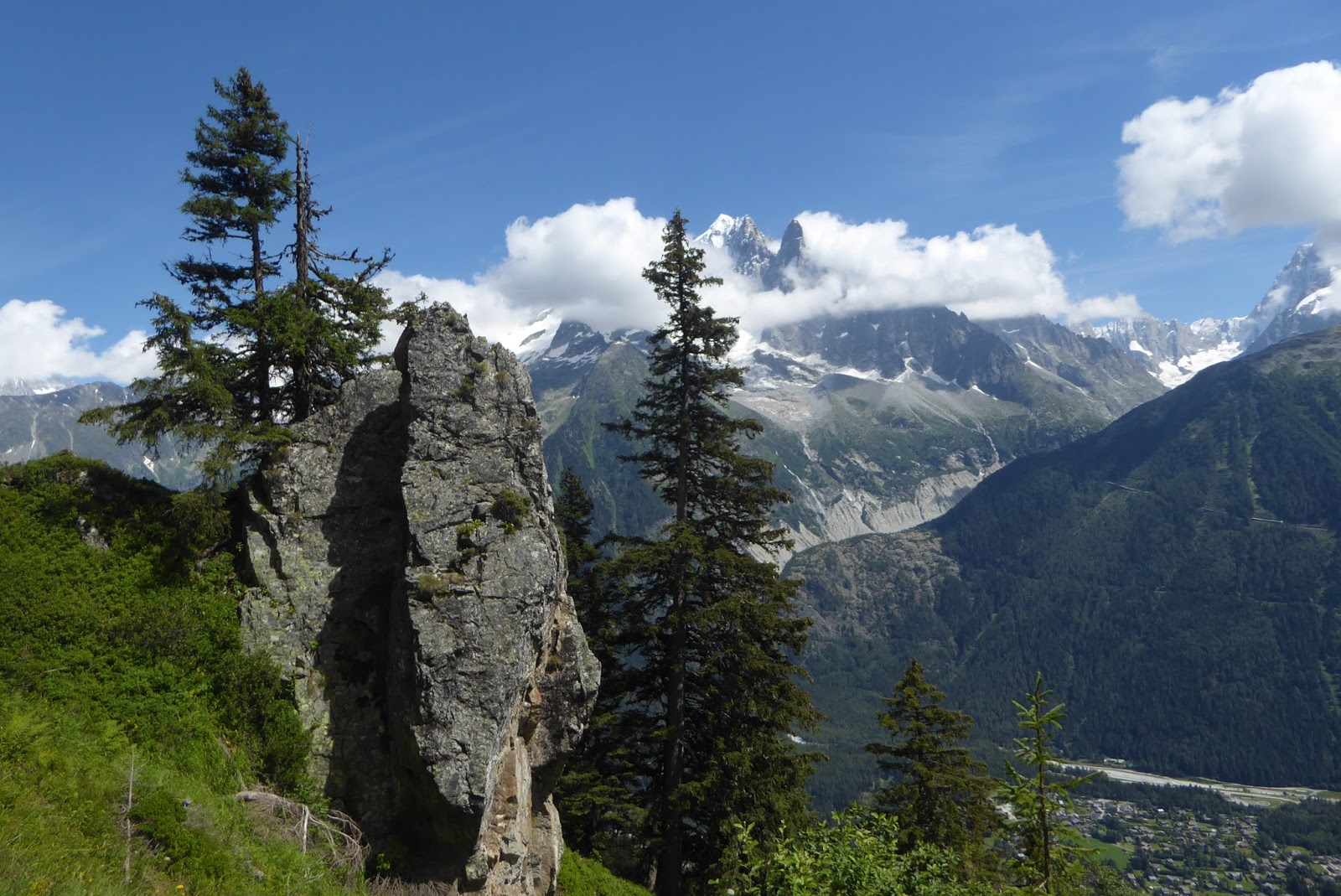
The Aonoach Eagach Ridge across Glencoe
It was decided that we'd head out together with the intention of climbing some of the easy classic climbs beginning with Dorsal Arete on Stob Coire Nan Lochan.
Friday began with cloud on the tops but fairly calm and dry, and we began by taking the relentless treadmill of 2 hours up to the cliffs of our mountain. We set the pattern for the next few days, climbing in two groups of three. We hardly belayed en-route but placed running belays as we went; the last climber removing the gear placed by the leader.
Two climbers ahead, on the narrow fin of Dorsal Arete
Dorsal Arete begins as a broad buttress of snow covered rock which narrows to a fine fin as it reaches towards the top. Everyone, even the less experienced climbers moved well and we soon got into a rhythm. The snow was thin over the rock but it was most enjoyable climbing. Topping out on the summit ridge we turned right to regain the corrie bowl and headed back down the steep valley to the glen.
Saturday we got going early to ensure we got back to the cottage in time for Six Nations rugby. The plan was to walk up Glen Eilde at the top of Glencoe to reach a fine steep ridge called Sron na Lairig. Saturday was sunny and our route was beckoning us on as we followed the icy path up the valley.
Walking a short section of Sron na Lairig, heading for the next steep bit.
 The final approach took steep snow to reach the rock at the toe of the buttress. We then headed directly up the starting rocks.
A succession of small false summits on Sron na Lairig
 Once again the buttress narrows and becomes a narrow crest in its upper reaches. It's quite exposed and lots of fun shuffling carefully along with steep, deep drops on both sides.
Looking down on the narrowest part of the ridge
Topping out we emerged onto a broad ridge, blasted by a vicious wind carrying sharp, cutting spindrift. We didn't linger, heading down the ridge in the sunshine, enjoying magnificent views across the mountains despite the hostile wind.
Sunday; day 3, Aonach Mor. Mark suggested heading north to take Aonoch Mor's ski gondola and walk to the mountain's west face. The route he had in mind was Golden Oldy, a route none of us had climbed before.
Toby swinging the axe as he climbs out of the crux chimney of Golden Oldy
 The route is graded 2 but at 450m rather longer than the first two climbs. The sunny theme continued as we made our way up the Allt Daim and the usual steep final approach to our climb. As usual the broad start offered a wealth of alternative lines but the ridge narrowed as we gained height.
Angus stepping carefully on the crest of Golden Oldy
 A steep chimney gave us a bit of ice before the ridge became a knife edge or snowed up rock. By this time we had become an effective climbing party and moved fast but we were undoubtedly tired by the time we reached the summit of our mountain.
Nearly at the top.
Mark and cake at the Gondola cafe
It's an easy walk off, however; cross the plateau northwards and drop into the top of the skiing area and follow the tows back down to the gondola and the delights of cake and coffee in the cafe.
When the weather's good like this it's hard to think of a better place than the Scottish Highlands for a short winter break.

Thursday, January 12, 2017

Navigation on Rudd Hill

I got out last Sunday with Mark for some navigation practice; he's shaping up for his Winter Mountain Leader Assessment in March and wanted to take the opportunity for a couple of hours work with map and compass.
As it happened conditions were pretty much perfect. There was a damp hill fog across the moors above Sheffield. We took the Ringinglow Road out past Lady Canning Plantation and parked up near Burbage Moor. The featureless moorland on either side of the road here offers few landmarks; it's a gently undulating blanket of peat covered in heather, moss and rushes. Yellow Nardus grass on the merely damp ground alternates with soft green pools of sphagnum moss in the bogs. The heather grows deep and makes walking difficult, a mild version of the difficulties of walking in deep snow Mark will have on his assessment on the Cairngorms.
We chose a few tiny pond features around Rudd Hill and set off to find them. The method used is to take a bearing using the compass from your known position to your destination, then keep track of your paces to know how far you've walked. On difficult walking terrain its hard to keep on your bearing, and hard to be accurate for the number of paces taken to walk each 100metres; it's even harder when the hill fog means you can't see more than 40 metres around. The challenge is to walk some hundreds of metres to find the correct pond in the midst of the moor. He hit every point, bang on.
We spent two hours happily walking about; Mark concentrating and doing the navigating, and me just having a nice wander. Strangely, I enjoy the intimate moorland landscape under these conditions. In the absence of wider views you're left with a close micro landscape and are much more aware of what's at your feet.

Sunday, January 8, 2017

Winter Walking Weekends around Hathersage and the Hope Valley

In early 2017 I'm offering guided Winter Walking Weekends in the Eastern Peak District, based in Hathersage. I'll be offering suggestions about travel and accommodation, then meeting my groups on Saturday and Sunday mornings to go for a whatever-the-weather walk. The choice of route will depend on the weather but here are some ideas of what is possible. Contact me directly if you're inspired or leave me a comment on this blog so I can get back to you.
Map of the area

Hathersage lies at the heart of the Eastern Peak District, about 16 kilometres from Sheffield on the Sheffield/Manchester Railway line. It's an ideal centre for walking with the hills rising above the valley shales to crests of dramatic bare gritstone. There is a fantastic net of footpaths woven through the valleys and over the high moors. The views are wide, across to the whaleback of Kinder Scout in the west and over the limestone White Peak, southwards.
Using the railway, it's easy to hop on for a couple of stops, either from Sheffield or from Hathersage, alighting to begin a walk from Edale, Grindleford or Hope Stations.

The Hope Valley in perfect winter weather

From Hathersage

From the wealth of walks starting in Hathersage my highlight would be the circular walk via the ghostly birchwoods of the old Bolehill Quarries over Owler Tor to reach, firstly, the Burbage Valley. Passing Higgar Tor we move on to walk the crest of Stanage Edge, the queen of the Derbyshire gritstone edges. Resisting the temptation to join the climbers, we drop back down southwards following the brook that tumbles back to Hathersage.
Stanage Edge, peerless gritstone rock
 Alternatively, take a different route, eastwards out of Hathersage to cross Higgar Tor and explore the breadth of the Burbage Valley passing via the Iron Age fort of Carls Wark and the Longshaw Estate (regional headquarters of the National Trust) and its visitor centre (good tea and cake). Finally, follow Padley Brook as it tumbles down its oak woodland gorge to join the Derwent. Our walk ends at Grindleford Station.

From Edale Station

Southwards there is the dramatic Iron Age fort on the summit of Mam Tor and the switchback ridge to Losehill above Castleton. This easy but airy grassy ridge divides the valley of Edale from that of Hope. From Losehill summit we turn down the hill to finish in Hope.
From Back Tor along the ridge towards Mam Tor

North of Edale rises Kinder Scout and a choice of paths – you can explore the Kinder Plateau taking in the summit of Kinder and Kinder Downfall looping back the finish where you started or, heading east you skirt the southern Edge of the plateau to reach the fine vantage point of Win Hill and back down to Hope Station. Both are high moorland walks in a unique landscape of rock and peat hags. This is as close as England gets to a wilderness. Gaiters are highly recommended.
The lower slopes of Kinder Scout

From Hope Station

Walking southwards takes you past Navio, the old Roman fort and up onto Shatton Moor. From here, crossing the moor eastwards brings you down through quiet valleys, eventually back to Hathersage
 Northwards from Hope leads up over the shoulder of Win Hill to the foot of the Ladybower Reservoir. Cross the dam and climb the slope that faces you, over the grit-sharp Bamford Edge and across to take in North Lees Hall (model for Thornfield Hall from Charlotte Bronte's “Jane Eyre”). It's all downhill from here, to the welcoming cafés and outdoor gear shops of Hathersage.
From Bamford Edge looking up the Hope Valley


From Grindleford Station

Another favourite of mine is the scenic and varied walk that climbs out of the tree-lined Derwent Valley to reach and follow the moor of White Edge. This route then turns back northwards to follow first Curbar, then Froggatt Edges before dropping down, past the historic Chequers pub to follow the river Derwent back to Grindleford.
Froggatt Pinnacle, looking over the Derwent Valley

Thursday, August 11, 2016

The Lacs Noir amongst the Aiguilles Rouge

The téléphérique from Plan Praz near Chamonix lifts you quickly up to nearly 1900m asl to La Flegère. Working on my fitness I walked from here up the piste to reach top of the Index chairlift. From here I was to descend for around 100m vertical before beginning the climb up a high, snow banked valley to reach the Col de la Glière. There had been warnings posted at the caisse where I bought my tickets - the advice for walkers was not to cross the Col because of snow but I wanted to check this out as I'm planning to walk this route next week with my group. I thought I'd walk up to the col and check out the problem but as it turned out the problem was before reaching the col.
Crossing the dodgy snow gully
Ahead of me I could see people picking their way carefully across a small snow gully. Without a rope for protection, crampons and an ice axe this can be a bit delicate. A slip will be hard to control and a fast slide will end up in rocks below. On the far side of this gully there were stanchioned hand rails where the path continued across steep rocks to the col. When I got up there I decided I didn't fancy the slippery snow and instead climbed above the snow to regain the path.
An icy Lac Noir in front of the Aiguille du Pouce
 After the excitement it was quickly to the col and then another 100m of up to get to the Lacs Noir which were ice filled and atmospheric below the rocky pinnacles of the mountains. The path slides onto the north side of the main ridge here to get to the next col from where a steep path zig-zags downwards. The views are magnificent and the path interesting once I'd lost a couple of hundred metres altitude. I chose the path advertised as 'steep' which followed a small subsidiary spur downwards through bilberries and little rocky knolls which framed a wonderful view of Mont Blanc and the Bossons Glacier cascading downwards towards Chamonix. 200 years ago this nearly reached the floor of the valley but it's melting back fast.
Mont Blanc and the receding Bossons Glacier
The Aiguille Vert and the Dru above some 'weeds'

This descent takes you back into areas of skiing detritus but not long after turning back towards La Flegère there's a turn, briefly uphill and then traversing a beautiful path.
Walkers silhouetted against Mont Blanc and Mont Maudit
 This path amongst mature conifers offers more of the fantastic panorama, southwards towards the high mountains. This is a pretty stunning walk.
 The distant Aiguille Vert nestled in cloud across the valley from the La Flegère path

Tuesday, August 9, 2016

Argentière


Argentière sits a few miles above Chamonix in the deep cleft of the vallée de l'Arve, below the highest mountains of the western Alps. I've come here to recce, then lead a week long walking holiday - day walks from a base in the village. I prefer Argentière to Chamonix; it's less busy, smaller, and was where I first came to begin my alpine mountaineering about 30 years ago.
I arrived on Sunday, greeted by 'beau temps', camped a night then headed yesterday up to Lac Blanc via the Aiguillette d'Argentière, a pinnacle of climbers' granite poised high above the village.
Back to Le Tour and the Aiguillette d'Argentiere
It's a steep walk, firstly shaded by conifers on a path which zig-zags up an 800m vertical height gain, to reach the traversing footpath below the Aiguilles Rouge. This followed by a further 400m upwards to the lake itself. I meet a couple of Israeli guys walking the Tour du Mont Blanc and we walked together - English our shared language. It was hot, even beneath the trees' welcoming shade, and by the time we climbed out above the tree line into the full power of the sun I was leaking sweat faster than I could drink. Around 1800m asl the path gets exciting as it traverses into the arena of the Aiguillette d'Argentière, from which the only escape for non-climbers is a series of ladders, ropes and stanchions. Up here the path winds a vertiginous route.
Ladders
Chamois and kid
Hereabouts the mountain chamois are accustomed to people and I passed several, nonchalant, perched near the path. Eventually, around 2100m the steep path joins the main popular route that reaches the Lac Blanc.
This section was very busy with walkers, queuing in places to use the wooden rungs fixed to aid the way over the steeper rocky slabs that bar the way to the lake. I don't much like these rungs, which can occasionally be wobbly, and the presence of queues of people above standing in loose scree makes me nervous. In the dry it seems preferable to trust to friction and wander up the clean rock just to the side.
The glacial troughs of the Argentiere Basin and the Mer de Glace enclose the Aiguille Vert
I didn't linger at Lac Blanc, beautiful though it is. In August the tourist hordes (I know I'm one of them) create a noisy massed picnic, harassed by flocks of Alpine Choughs for easy pickings. I preferred to return a little for my picnic, dropping down to find a much smaller pathway leading off the beaten track down to the Lacs de Cheserys.
Lacs de Cheserys
Alpine Newt
These lower lakes don't have the alpine majesty of Lac Blanc but are quieter. I dangled my feet in the cold water and watched an Alpine Newt swim past on a mission.
Perhaps the most obvious wonder of this walk is the view. The Aiguilles Rouge on which this walk lies face northwards to the grand peaks, the Aiguille du Chardonnet, Aiguille Vert, all the cluster of Chamonix Aiguilles and finally the remote white dome of Mont Blanc rise across the valley on a scale which is difficult to comprehend even as you gaze across.
Mont Blanc across the void
Aiguille Vert
The ranges are split by the wide gulfs of the Argentiere Glacier and the Mer de Glace, though these glaciers are visibly reduced since I was first here thanks to climate change. It's an inspired and mighty sight.
Climber between pinnacles on Aiguillette d'Argentiere
After a picnic by the Cheserys I plunged back down the ladders and into the woods, an hour and a half of rapid descent back to Argentière.
  
Back in the shade, but still high above Argentière